Is Arctic Sea ice melting? As most of us already know, the ice cover on Earth is constantly changing. Some records date decades and measure the mass balance between the current glacier terminus and its prime location back in 1850 AD. This glacier has been visited every year for the next decade — there was a visual recession at the peak.
However, such field measurement methods are expensive, time-consuming, and laborious. The data is only collected from some glaciers. Thankfully, the advancements made in CubeSat camera technology have opened countless opportunities for observing and studying glaciers.
What Is Remote Sensing?
CubeSat cameras are often used for remote sensing these days. Remote sensing can be described as the acquisition of information about anything without having to touch it physically. We have been ‘remote sensing’ the world around us with the help of our eyes since the evolution of human beings.
Once you fit cameras on satellites and send them up to space, you will be able to observe the behavior of space on a much larger scale. Thanks to these repeated images, you can follow the changes in the glaciers worldwide.
When it comes to obtaining information via remote sensing, it usually includes aerial photographs from planes or drones, ground-penetrating radar data, and multibeam swath bathymetric data from ships. However, we concentrate only on remote sensing data obtained from CubeSat satellites.
CubeSat satellites are small satellites that keep orbiting the Earth and clicking images at different bands on the electromagnetic spectrum, like thermal infrared. With the help of these images, you will be able to make regional assessments more efficiently. Since each image is captured at a different CubeSat camera resolution, you can use them for various purposes. With the help of satellite data about ice in Arctic Sea, you will be able to monitor the current position, equilibrium line altitude, length, area, velocity, surface elevation, etc., of the glacier.
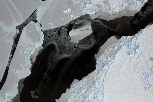
What Satellites Monitor Arctic Sea Ice?
Most people have the question – what satellites monitor Arctic Sea ice? Well, the answer is not easy. States do not disclose the satellites they use for Arctic Sea ice analysis. While we cannot reveal the name of the satellites used to monitor the Arctic Sea ice, we can provide the name of one satellite that the team from the Dalian University of Technology has developed.
The satellite research team of the Dalian University of Technology used a 12U CubeSat to observe sea ice and gather more data in the Bohai Sea, Yellow Sea, and the Arctic. This mission was dubbed the Small Bright Eye (SBE), a 20kg, 12U high-resolution CubeSat. One of the primary payloads of this satellite is the PAN/Multispectral high-resolution camera.
In terms of monitoring, the resolution of the camera is excellent. The wide field of view can reach 11.5 km, with a pointing accuracy of fewer than 0.05 degrees. This Arctic Sea ice monitor satellite was launched at the end of 2021. The satellite images are provided in real-time and high-resolution for satellite tracking of Arctic Sea ice. With the help of these satellite images of Arctic Sea ice, you will be able to observe and analyze the sea ice and provide practical reasons for its abnormal decline.
What Are Some Other Glaciological Applications of These Satellites?
Apart from helping you detect a reduction in the glaciers and ice at the Arctic Sea, a CubeSat camera is also useful for various other applications, some of which include:
1. Equilibrium Line Altitude Mapping
Glacier data like snow cover, thickness, altitudinal range, and glacier length can be used to calculate the ELAs (Equilibrium Line Altitudes) of the region. With the help of this data, you should gain more information on the mass balance of the glacier, which is quite an essential glaciological parameter. This can help you answer various important questions, like how much Arctic Sea ice has melted, etc.
2. Snow Cover Mapping
With the help of Arctic Sea ice measurements by satellite, you will also be able to map the snow cover of the region. There are many critical applications of understanding the balance between glacier mass and the behavior of perennial water resources and snow patches. Algorithms can be used to classify the terrain automatically based on the reflectance value, like green land, dark water, white snow, etc.
3. Glacier Landform Mapping
Satellite remote sensing technology has revolutionized glacial geology. With the help of the large swaths, you will be able to map previously deemed difficult or even impossible areas. One of the most notable examples is the mega-scale glacier lineation. With the help of the CubeSat camera modules, you can easily map these terrains in the Northern Hemisphere.
4. Ice Sheet Bed Measurement
One of the critical parameters required to drive glacial, and ice sheet numerical models is information and data on bed topography. However, it is nearly impossible to reach the bed of any glacier. In such cases, satellite camera modules can help provide the required information by penetrating the ice, thereby helping you map the geometry of the ground underneath the ice.
Final Thoughts
So, why is Arctic Sea ice declining? There are several reasons for that, with climate change due to pollution being on top. However, satellite images shot with modern CubeSat cameras can help provide an answer to these questions, and we can analyze various paths that we can take to combat or understand the processes.