Nasarawa is a state located in the north-central zone of Nigeria. The capital of Nasarawa state is Lafia. Nasarawa was created on the 1st of October, 1996. It was carved out from its neighbouring state, Plateau state by the then Abacha government.
Nasarawa state shares boundaries with Kaduna state to its north, with Abuja, the federal capital territory to its west, Kogi state and Benue state to its south and to its east by Taraba and Plateau States. There is also a network of roads that links the rural states and major towns in the state.
The mainstay of Nasarawa State is agriculture with the production of a variety of cash crops throughout the year. The state also has various minerals such as salt which are mostly mined by local miners in the area. Nasarawa state is home to the Farin Ruwa Falls located in Wamba Local Government area of the state. Farin Ruwa falls is referred to as one of the highest waterfalls in Africa. Another tourist site in Nasarawa State is the Maloney Hill.
Keana Local Government Area in the state is referred to as salt village. Here, iodized salt is produced naturally from a lake near the local government. This article covers the list of local government areas in Nasarawa state and other information you need to know about them.
List of Local Governments in Nasarawa State
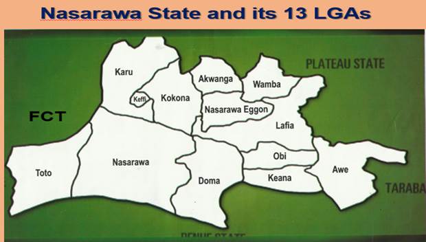
Read on below:
Akwanga
Akwanga LGA has its headquarters in the town of Akwanga. According to the 2006 population census, Akwanga has a population of 513,930 people. The popular languages spoken in Akwanga are the Plateau languages. Akwanga is often referred to as the centre of education in Nasarawa state because of its wide array of primary, secondary, and tertiary institutions.
Doma
Doma has its headquarters in the town of Doma. According to the 2006 population census, Doma has a population of 139,607 people. The postal code of the area is 950. An annual festival celebrated in Doma local government is the Odu festival. The major occupation is farming and the predominant tribe is the Alago people.
Eggon
According to the 2006 census, Eggon has a population of 149,129 people. Eggon LGA has its headquarters in the town of Eggon. It also consists of other towns and districts.
Karu
Karu local government area is very close to the Federal Capital Territory of Nigeria. Karu local government has its headquarters in New Karu town. The local government was originally built to house civil servants and lower-income families in Abuja, but has now grown in population beyond its original planned capacity. To ensure administrative convenience in the local government, Karshi Development Area was created with its own administrative secretariat at Uke.
According to the 2006 census, the population of New Karu town was 205,477 people. The urban area of Karu has an expressway that connects it to Abuja and other parts of the country.
Keana
Keana has its headquarters in the town of Keana. According to the 2006 census, the LGA has a population of about 80,000 people. It is also home to the Federal Government Girls College at Keana.
Keffi
Keffi is a town in Nasarawa State. Its headquarters are in the town of Keffi. According to the 2006 census, Keffi has a population of about 92,664 people. The postal code of the area is 961.
Keffi town was founded around 1802 by a Fulani warrior leader called Abdu Zanga who then took up the title of emir. He was however subject to the Zaria emirate where he had to pay an annual tribute of slaves. Keffi is quite a historical town as in the year 1902, an incident happened in Keffi that led to the British invasion of Northern Nigeria. This was after the “magaji”, a representative of the sultan of Zaria in Keffi killed a British officer. The Magaji fled to Kano for refuge. This was the pretext for Lugard to invade the northern caliphate Its headquarters are in the town of Garaku. According to the 2006 population census, Keffi has a population of 109,749 people. The postal code of the area is 961
Lafia
Lafia is the capital city of Nasarawa state. According to the 2006 population census, Lafia has a population of 330,712 people. It is the largest town in Nasarawa state. Lafia is also known as Lafian Beri-Beri. The town was founded by Muhammadu Dunama in the late 17th century. The indigenes of the site where the town was founded migrated southwards. In the late 19th century, Lafia later became the capital of a prominent local chiefdom. The Lafia market is also one of the most prominent in the area. Lafia has large populations of other ethnic groups such as Igbo, Hausa because of the hospitable nature of the indigenes. Lafia is also an educational centre in Nasarawa state. The major occupations of the residents of Lafia are farming, cotton weaving and dyeing. Livestock rearing is also a prominent activity amongst the Fulani herdsmen in the area.
Nasarawa
Nasarawa LGA has its headquarters in the town of Nasarawa. According to the 2006 census, Nasarawa has a population of 189,835 people. The postal code of the area is 962. The major occupation in Nasarawa are farming and tin and columbite mining.
Obi
Obi has its headquarters in the town of Obi. According to the 2006 population census, Obi has a population of 148,874 people.
Toto
Toto has its headquarters is in the town of Toto. The local government area shares boundaries with Abuja to its north, Nasarawa local government area to its east, and Kogi state to its south and west. According to the 2006 census, Toto has a population of 119,077 people.
Wamba
Wamba has its headquarters in the town of Wamba. According to the 2006 census, Wamba has a population of 72,894 people. Wamba town is located close to the beautiful Farin Ruwa Falls which is referred to as one of the highest waterfalls in the whole of Africa. The source of the waterfalls is the Jos plateau.